
A spy-satellite simulator in your browser — then you realize the sources are public and the data is real.
Photorealistic 3D globe. Live aircraft, ships, satellites, earthquakes, traffic, and public cameras. Hands-free voice control powered by a realtime AI agent.
No place left behind.
🏆 Reached #1 on GitHub Trending, daily and weekly · August 2026
#8 Product of the Day · Hunted by Chris Messina, creator of the hashtag
“pretty cool” — Brendan Eich, creator of JavaScript and co-founder of Mozilla and Brave · Featured on Pinokio
⚡ Start without API keys. Install with Pinokio or run locally from the terminal. Add optional keys inside the app. → Quick Start
Quick Start · First Five Minutes · Talk to It · What's Live · Your Security Cams · Under the Hood · Keys & Costs · Contributing
God's Eye View brings public signals into one explorable globe. Track the world live. Talk to it. Break it. Extend it.
Flight transponders, ship beacons, orbital elements, seismographs, and public cameras already tell us a lot about the world. God's Eye View puts them in the same place, so you can move between a global picture and an individual aircraft, ship, or street. It runs locally in your browser, with source code you can inspect and extend.
Half the magic is that it looks like a forbidden cockpit. The other half is that every line of code is inspectable.
Most feeds are live or regularly refreshed. Traffic is simulated along real roads using aggregate location data. CCTV camera poses and rocket launch trajectories are coarse estimates.
Start with the included data sources, then add your own. Each layer is a separate module.
- 🛩️ Cockpit view: Ride inside a tracked flight — the camera holds the terrain under you all the way down.
- 📡 Contacts: A 250 km roster of everything near your target — step through live aircraft and drop into any cockpit.
- 🎯 Click-to-track anything: Camera locks on, draws a fading trail, surfaces full metadata — and a tracked fire or vessel hands you off to the nearest live camera in one click.
- 🖊️ Voice whiteboard: Speak annotations onto the world — real boundary polygons, marks, and routes.
- 🛫 3D hangar: Real per-class aircraft models — 787, ATR-72, Citation, Bell 206, MQ-9 — and a tracked contact swaps from glyph to 3D model as you close in.
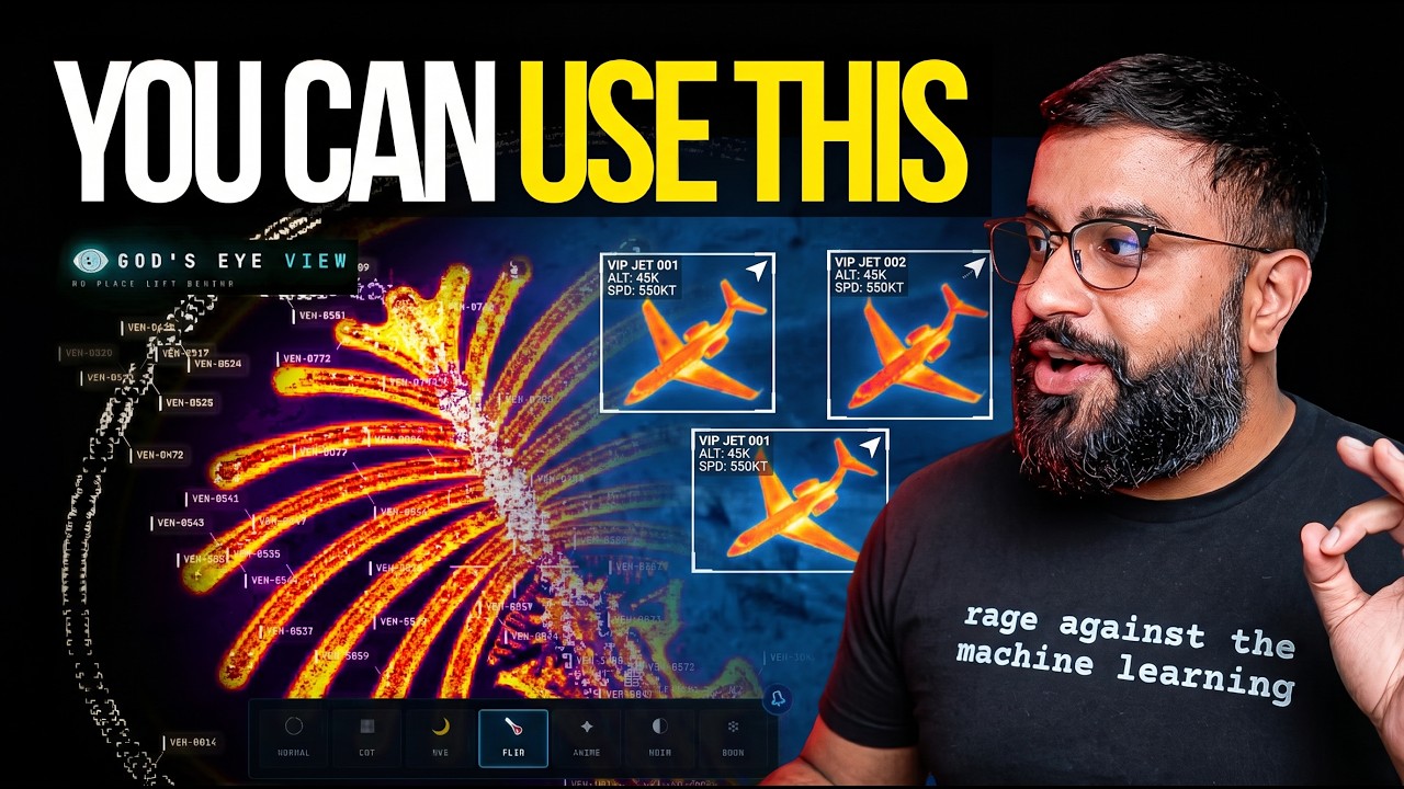
- 🎨 Reskin reality: GLSL sensor looks over the normal globe — CRT, NVG, FLIR/thermal, Noir.
- 🟩 Detection overlay: Screen-space bounding boxes and IDs on everything in view.
- 🎖️ Military HUD: Tactical heads-up display with intelligence-style telemetry.
- 🌐 Global Context: Stage the full situational picture with one switch — and get your exact view back when you leave.
- 🎥 Scene director: Capture cinematic camera tours for clips and demos.
- 🔗 Share Links: Camera, style, layers, and even one tracked target serialize into a URL — a live target is a handoff, not a bookmark.
- 🏠 Reset Globe: One control — or one sentence — back to the full Earth.
- 🌦️ Weather: Animate GFS or ECMWF forecast wind, replay observed radar, satellite clouds and lightning on one timeline, and follow NHC/CPHC cyclone tracks. No key needed.
- 📷 Mapped ALPR cameras: License-plate-reader camera locations tagged in OpenStreetMap, one city at a time. Locations and tags only; no key needed.
- 🔭 Satellite passes: Ask by voice when any loaded satellite next rises over you: rise, peak and set times, and whether you can see it.
- 🔎 Analyst answers: Count, filter and rank satellites, datacenters and dams by voice, alongside flights, ships, fires and quakes; answers say when a feed is stale or on a fallback.
- 🧭 Tilt and North Up: Switch between straight-down and a 35° oblique, or put north at the top, while a tracked target stays centered.
- 🔍 Keyless search: Type decimal coordinates, a two-dimensional WGS84
geo:URI (for example,geo:39.7392,-104.9903), or a bundled city or landmark to fly there with no geocoder request; other names use Google when configured, then Photon and Nominatim. - 📦 Shareable scenes: Import, preview and share Director scenes as files or bundles, with camera anchors, authored moves and data packs.
- 🌊 Nepal flood scene: Replay the Bhote Koshi flood: flood path, witness sources and before-and-after imagery (bundled data is non-commercial; see DATA_SOURCES.md).
Local setup needs no account or API keys. The app opens with Esri satellite imagery and keyless terrain. OSM is the fallback if Esri is unreachable. Flights, military traffic, satellites, earthquakes, public cameras, radio, and launches are available without keys.
For photorealistic 3D, add a Cesium ion token for eligible personal, non-commercial use, or a Google Maps key for the direct, metered route and Google place search. Provider terms and quotas apply. Add keys through the app's POWER UP panel; Keys & Costs explains the options.
Already installed? Update to the latest version. Older versions query public OpenStreetMap Overpass servers, which now refuse them, so Traffic, Mapped Installations and ALPR stay empty until you update.
- Install or update Pinokio to 8.2 or later.
- Open God's Eye View in Pinokio.
- Click Install, then Start.
Available on Windows, macOS, and Linux. The Pinokio maintainer reports cross-platform testing of the fixed installer. The launcher installs the locked dependencies, finds a free local port, and opens the app in your system browser. The Server menu item keeps the launcher console available.
Tried before and installation failed? Update Pinokio and try again. Version 8.2 fixes the launcher installation issue; details from the Pinokio maintainer.
Using an older launcher or opening the embedded view manually? If the globe is very choppy, before treating that as a GPU compatibility or minimum-hardware problem, copy the local server URL shown by Pinokio and open the same URL in your normal hardware-accelerated browser. One Pinokio 8.2.0 user reported severe stutter in Pinokio's embedded view that went away when the same running server was opened in an external browser (#365). That points to the embedded browser rather than the app server or your hardware; it does not establish a minimum GPU requirement.
Use Node.js 24.x (24.14.0 or later) or 26.x; 24.22.1 or later (26.12.1 or later on 26) includes the October 21, 2026 security fixes, among them CVE-2026-111497. The setup doctor warns about Node 25, which is end-of-life.
git clone https://github.com/bilawalsidhu/gods-eye-view.git
cd gods-eye-view
npm ci
npm run doctor
npm run dev
Open http://localhost:4173. Choose Live Contacts, Space Missions,
Environmental, or Explore Manually from the first-run panel.
npm run dev runs the server under a supervisor that relaunches it after a
crash or a hang and logs every exit, with the reason, to
.gev-logs/dev-server.log. Port 4173 is strict: a busy port fails the start
instead of moving to the next one (set PORT= to use another).
http://localhost:4173/__gev/health reports the server's pid, uptime, memory,
handle counts and restarts while it runs. npm run dev:raw runs Vite directly,
without the supervisor.
Startup performance
A point-in-time M5/Chrome capture measured a median 1.86-second cold start. This is a comparison baseline, not a guarantee for your machine or connection. See docs/PERFORMANCE.md.
macOS shortcut: ./scripts/dev-fresh.sh clears the Vite cache and pulls any
configured keys straight from the Keychain. It starts keyless too.
No Node install needed; the container publishes the same dev server.
git clone https://github.com/bilawalsidhu/gods-eye-view.git
cd gods-eye-view
docker compose up
Open http://localhost:4173 as above. Everything the app saves stays in the folder you cloned, so docker compose down never loses anything:
.env- your API keys, whether saved from Provider Settings or typed in by hand.gev-cache/- downloaded map and satellite data, so later starts are faster.gev-logs/- logs
Back up that folder and you've backed up everything; delete .env to forget your keys. Source edits still hot-reload. The port is published to 127.0.0.1 only, so the default matches the native one.
The local MCP server and ChatGPT OAuth voice are not available under Docker; use an OpenAI API key for voice.
Publishing it wider is the Sharing an instance opt-in, and it hands out Provider Settings too: the launcher trusts the container gateway as this machine, and a wider publish delivers everyone else from that same address. For an instance you mean to share, put the keys in .env by hand instead. SECURITY.md has the detail.
When you widen the publish, also set GEV_KEY_SETUP_TRUSTED_PEERS=none so the launcher trusts no gateway address.
GEV_KEY_SETUP_TRUSTED_PEERS=none docker compose upCompose forwards GEV_KEY_SETUP_TRUSTED_PEERS and GEV_ALLOWED_HOSTS from your
shell or the project's .env; an exported shell value takes precedence. You can
also put GEV_KEY_SETUP_TRUSTED_PEERS=none in .env for a persistent setting.
Unset or blank trusted peers retain automatic gateway discovery; none explicitly
disables it. The startup log confirms that no additional peers are trusted.
Running on Linux, a NAS, or behind a reverse proxy
Run it as the user who should own the files it writes. id shows the numbers; for yourself on Linux:
env UID=$(id -u) GID=$(id -g) docker compose upOn a NAS, clone onto the share you want the data on and use the share owner's ids:
cd /volume1/docker
git clone https://github.com/bilawalsidhu/gods-eye-view.git
cd gods-eye-view
env UID=1026 GID=100 docker compose up -d
Keep the env: bash treats UID as read-only, so a plain UID=1026 in front of a command is silently ignored. If the container can't write the checkout, it says so at start. Docker Desktop on macOS and Windows maps ownership for you.
On SELinux hosts (Fedora, RHEL), compose mounts the checkout with :z so the container may read it; Docker may relabel the checkout for container access, which can take a moment on a large checkout. Without that, the start fails with Cannot find module '/app/scripts/docker-start.mjs'.
Behind a reverse proxy, put your keys in .env or pass them as environment variables - Provider Settings refuses proxied requests on purpose - and add the hostname you serve it on, for example GEV_ALLOWED_HOSTS=globe.example.lan (see Sharing an instance). The map routes compare the browser's Origin with the Host the server sees, so the proxy must pass the original Host and, when it terminates TLS, X-Forwarded-Proto. Caddy does both by default; for nginx add proxy_set_header Host $http_host;, proxy_set_header X-Forwarded-Proto $scheme; and proxy_set_header X-Forwarded-For $proxy_add_x_forwarded_for;. On an install outside Docker, that forwarding header also rate-limits the proxy's users apart from your own browser. Under the default Docker bridge network every client on the host, your browser included, reaches the container from its gateway address and shares one Overpass bucket.
IPv6-only networks, rebuilding, and the test suites
The launcher reads the IPv4 default gateway, so an IPv6-only Docker network
finds none: it logs No default gateway; Provider Settings stays loopback-only
and the panel refuses every save. Put your keys in .env by hand there, or name
the gateway yourself with GEV_KEY_SETUP_TRUSTED_PEERS after reading
SECURITY.md.
node_modules deliberately stays inside the image, so it survives in an
anonymous volume across restarts: after a git pull that changes dependencies,
recreate it with docker compose down -v && docker compose up --build. The
image also skips Puppeteer's Chromium download, which keeps it small but leaves
npm run test:track to the host — npm run build and npm test run fine in
the container.
Codespaces requires a GitHub account. Overpass queries and OpenAI voice token
requests return HTTP 403 through its forwarded HTTPS URL, even with API keys
in .env and GEV_ALLOWED_HOSTS configured. Use a local setup for these features.
The codespace runs the dev server in a cloud workspace, so Node and the dependencies never touch your machine. The globe still renders in your own browser, so it needs the same graphics there as any other path. GitHub Free includes 120 core-hours a month with no card on file — about 60 hours on the default 2-core machine. Org and Enterprise plans include no free quota; current terms and quotas apply.
- Fork this repository, then open your fork on GitHub.
- Click the green Code button, the Codespaces tab, then Create codespace on main.
- In the codespace terminal:
nvm install 24 && nvm use 24
npm ci
npm run doctor
GEV_ALLOWED_HOSTS="$CODESPACE_NAME-4173.$GITHUB_CODESPACES_PORT_FORWARDING_DOMAIN" npm run dev
- Open the Ports tab, find
4173, and click the globe icon to open it in the browser. The port is private by default, so the URL asks for your GitHub login. Keep it private: a public port lets anyone use the app and the keys in your.env.
GEV_ALLOWED_HOSTS there is required, not optional. The dev server answers only
the hostnames it trusts, and a forwarded port arrives on
$CODESPACE_NAME-4173.$GITHUB_CODESPACES_PORT_FORWARDING_DOMAIN. Without it the
page is Blocked request. This host is not allowed. Leading-dot wildcards are
ignored on purpose, so pass that exact name.
.env. SECURITY.md has the threat model.
For a local setup, keys are upgrades, not prerequisites. When you want one,
click the POWER UP chip in the bottom-right corner: Provider Settings lists every supported key,
what it switches on, and where to get it. Paste, hit SAVE KEYS, and the app
restarts itself with the new capability on. Once everything is configured the
chip reads POWERED UP — and if a compact layout hides it, ?setup=1
reopens the same panel.
- Where keys land: Pinokio → the app's ignored
pinokio/ENVIRONMENT; a terminal clone → the repo-root.env. Either file is made owner-only before a secret is written into it. These are local plaintext files, excluded from Git; the app uses your keys to contact the providers. - Keys you already have stay yours: values from your shell or the macOS Keychain show as configured externally and are read-only to the panel.
- What to get first: the free Cesium ion token (eligible personal, non-commercial use; current terms and quotas apply) for photorealistic 3D and world terrain; a Google Maps key only for the billing-enabled, metered route + Google place search; OpenAI when you want to talk to the world. Full map, costs included, in Keys & Costs.
- Your own security cameras: below the keys, **HOME SECURITY · and BUSINESS SECURITY add any number of private sites and cameras — through Home Assistant, a username + password snapshot address, or the browser feed relay. Setup, notes and limits: Your Own Security Cameras.
The server binds to localhost on both paths, and Provider Settings answers
requests only from your machine and, with GEV_TAILNET_DASHBOARD=1, your own
phone over Tailscale
(Mirror of PC GEVC on Cell:
the PC's dashboard on your phone, where everything works except removing
or deleting what is stored on the PC). Browser-side keys (Google Maps, Cesium ion)
must be restricted at their providers — SECURITY.md shows how,
and it carries the LAN-sharing rules alongside Keys & Costs.
Choose a first-run mission, or try these in order. The GIFs show Google Photorealistic 3D; your starting basemap depends on the keys you've added.
- Light up the sky. Take the Live Contacts mission (or turn on Flights yourself) — thousands of live aircraft, gliding on real telemetry, detection mesh already reading the scene. Click one: the camera locks on, a trail draws behind it, and its live telemetry card comes up.
- Take the controls. Hit COCKPIT on your tracked plane and ride it down, switching sensors mid-flight: NVG into Ironbow FLIR.
- Drop into a busy airport. Search one and descend to the taxiways with 3D aircraft on — grounded contacts, taxi trails, the whole apron working in real time.
- Look through a public camera. Pick a city in Canada, the US or one of 166 other countries and territories and turn on Cameras (the CCTV layer) — the nearest public cameras load, up to 1,000 within 50 km of the place you picked. Pick a city outside that area and the cameras move with you, even within one state. Austin and London add their live city packs when you select them (California's Caltrans pack also needs
CCTV_CALTRANS_DISTRICTS), and the live packs reach further — Finland, Delaware (live video) and more. The feeds aren't webcam embeds — they project into the 3D city. Cycle coverage to VIEWSHED and every camera draws its estimated coverage volume — where it reaches, and where it goes blind.
- Track something in orbit. Turn on Satellites and click the ISS — you ride along at orbital distance, orbit ring and all.
- Switch the optics. Tap
1–6— CRT, NVG, FLIR — and the whole live planet re-renders through a different sensor.
- Talk to it (needs an OpenAI key): "Take me to LAX and select the nearest airborne aircraft."
- Come home. Hit Reset Globe — or just say "zoom out to a globe view."
Keyboard: 1–6 visual styles · H HUD · D detection · C cockpit · ` frame rate · Esc out. Trackpad pinch zooms the globe.
Every plane should let you do this.
Real-time cockpit mode, built from live flight data: the camera rides your contact with real terrain holding underneath, all the way down — sensor styles come along for the ride, and Contacts keeps the 250 km roster one click away: jump plane to plane and fall straight into the next cockpit.
The cockpit even carries its own briefing strip: nearby live signals, regional headlines, and real local weather — with an opt-in WX mode that renders volumetric clouds from actual observations around your aircraft.
Why cockpit mode exists: you're riding a real aircraft over real terrain — and you get to pick which sensor you see the world through.
The standalone app offers OpenAI and Gemini under AI Provider in Settings, one choice shared by voice and chat. OpenAI is the initial default; your choice is saved in this browser. To use Gemini, add GEMINI_API_KEY in Provider Settings or your local .env file, then select Gemini. GEMINI_LIVE_MODEL defaults to gemini-3.8-live. The permanent key stays on the local server, which issues a constrained, single-use session credential.
Changing provider ends the current conversation. If voice is on, the new provider starts with the same open-mic or push-to-talk mode; a held Space key is not carried over. Gemini uses the same map actions and captions, but has no OpenAI cost meter or MINI tier. When Gemini reports that its session has expired, start voice again for a new conversation. The AI Provider setting does not change the OpenAI-backed AI HUD summary.
Next to the mic, CHAT opens a typed chat with silent replies. It uses the selected provider and the same map actions, and never asks for the microphone. OpenAI chat needs an API key (OPENAI_CHAT_MODEL), so it is off while GEV_PREFER_CODEX_OAUTH pins OpenAI to ChatGPT OAuth; Gemini chat uses a separate text model (GEMINI_CHAT_MODEL). Chat and voice panels share the left panels' glass surface and sit above the dock or dock to the right.
Voice starts on an OpenAI key. On the same machine it can instead use an opt-in signed-in ChatGPT/Codex OAuth session; the API-key path remains the default. Selecting ChatGPT OAuth in Provider Settings reuses an existing local sign-in or starts the Codex browser sign-in flow and selects OAuth when it completes. The mic's provider control also runs the same commands through Claude, a custom endpoint, OpenRouter, Grok, or NVIDIA, using the keys already saved for Ask. Without a key for the provider you picked, the app still runs — the mic button just reports voice is unavailable. The OpenAI key still drives the AI HUD summary: a terse, five-word intelligence-style readout of the current view that regenerates as you move.
The OAuth option is experimental. OpenAI documents ChatGPT plan usage for the Responses API; a supported third-party Realtime contract for reusing Codex tokens has not been confirmed. A successful token mint does not establish billing or support terms.
GEV reads Codex's file credentials but does not write or refresh them. It checks token shape and expiry, and reports expired sign-in as requiring re-authentication. The login button runs codex login, permits one pending attempt, and reports exit failures or a two-minute timeout. CODEX_HOME must match the directory that Codex uses. If CODEX_AUTH_JSON points elsewhere, sign in separately or fix that mismatch before using the button. Codex credential storage must use auth.json; Keychain-only and in-memory storage are not readable by GEV. On Windows the button starts Codex without a shell: Codex's own codex.exe, else an npm-installed Codex's codex.js run with Node (the codex.cmd shim itself is never run), found on PATH folders given as full paths. Set CODEX_BIN to a full path when Codex is elsewhere. See Codex credential storage.
For a live voice check, run node scripts/qa-voice-auth.mjs http://127.0.0.1:4189 oauth microphone.wav against your local dev server. Use a WAV with three seconds of leading silence followed by a short spoken reply request. Replace oauth with api-key to check the API-key path. The check verifies audio input, a completed spoken reply, usage, resource cleanup, and reconnect. It saves screenshots and credential-free results under .gev-logs/voice-auth/.
Click GEV MIC, grant the microphone, and just talk. This is more than a voice-controlled remote:
- 🧠 It knows what it's looking at. The agent pulls live scene context before answering — including coordinates, street names, active layers, and view scale. Ask "what city is this?" mid-flight and it knows.
- 🎯 Entity Q&A. Click any plane, ship, or datacenter and ask "what's this?" It answers using the object's live telemetry.
- 👁️ Visual grounding. At street level, it reads a viewport screenshot to identify legible signage and building names, and is instructed never to hallucinate labels.
- 🎬 Cinematic framing. "Show me the planes overhead" pulls the camera back, angles it, and frames the live traffic like a director.
- 🔒 Honest and secure. The agent only confirms actions that succeeded. Your
OPENAI_API_KEYnever touches the browser; the client only gets a short-lived session token. If you choose USE CHATGPT OAUTH in Provider Settings, the local server uses that sign-in only to mint the same kind of short-lived Realtime credential, and refuses the OAuth path for non-loopback clients. - 🎙️ Same commands, more voices. Grok is a live voice socket; the xAI key stays on this machine and the browser only receives a short-lived secret. Claude and NVIDIA use this browser's speech. OpenRouter transcribes and speaks on its audio routes. A custom endpoint does that when it has audio routes, and this browser's speech when it does not. Those five do not use the OpenAI spend cap, and a street-level screenshot stays on the OpenAI session.
Thirty-two tools — the commands below come straight from the product's voice test suite and tool playbook:
🎥 Direct it — drone-operator camera verbs:
“Rotate the globe” spins Earth to the right continuously; ask for left, a speed, or stop. If it refuses, follow its reset-and-rotate or further-zoom guidance; camera input stops rotation.
🗣️ "Take me to Tokyo." · "Orbit around this area slowly." · "Draw the walking route from the Capitol to Zilker Park." → "Fly the route we just drew." · "Zoom out to a globe view."
🖊️ Annotate it — a whiteboard over the real world:
🗣️ "Outline the state of Texas." · "Annotate the Texas State Capitol and its grounds" — it draws the actual enclosing boundary, not a circle. · "How far is the Eiffel Tower from the Louvre?" — a connector arrow appears and it speaks the distance. Everything persists until you say "clear the map."
🖐️ Press anything — every button, menu, tick, slider and text field in every box (Outbreak, Ultra, Social Media, Street Level, Ask, POWER UP) is reachable by its label:
🗣️ "Open Outbreak and set the pathogen preset to measles." · "Run the epidemic model." · "Set compare against to no interventions." · "Set variant emergence to second strain." · "Set hospital stay to twelve days." · "Download the epidemic results." · "Untick show photos on map." · "Search posts for flooding in Calgary." — a closed box opens first. Buttons that delete, clear, send or share wait for your spoken yes, and key or password fields are left for you to type. The epidemic model is a scenario tool for exploring what-ifs, not a forecast of real cases.
🚆 Every rail line on the globe — Outbreak finds every rail line on the globe once in the background, lights it by reach from every outbreak and every landing, and carries rail travellers in the epidemic model.
✍️ Or draw it yourself — UTILITIES ▸ Draw: pick Area, Line or Pin and a colour, click the vertices on the real world, double-click to finish, then name, recolour, hide or fly to each shape from its row. Same whiteboard, same persistence, no microphone needed.
🔎 Interrogate it — analyst queries against the live layers:
🗣️ "How many flights are over Texas right now?" · "Which ships are headed to Oakland?" · "What is the biggest fire near Los Angeles?" · "Is anything flying above forty thousand feet?" · "When does the ISS pass over next?" · "How many datacenters are in view?"
🎛️ Operate it — the whole console, hands-free:
🗣️ "Switch to night vision and turn on the flights layer." · "Turn on the camera viewsheds." · "Play a news radio station near Austin." · "Track that plane." → "Enter Cockpit."
And the rapid-fire tier — one sentence each:
🗣️ "Show me global infrastructure." (stages the layers and pulls back to the globe) · "Play Orbital Watch." (a full cinematic scene) · "Set detection density to fifty percent." · "Next contact — helicopters only." (mid-cockpit) · "Show me space missions." · "Switch to OSM." · "Sharpen the image a touch." · "Switch to the tactical layout." · "What's turned on right now?"
Ask for radio near anywhere and the globe starts broadcasting — every station is a real place you can fly to.
💬 Or ask from Claude and Codex. God's Eye View is also an MCP server: ask Claude Desktop, Codex or ChatGPT desktop to show a place, and the live globe opens right in the conversation. Setup takes a minute — see docs/MCP_SETUP.md.
Twenty-two layers and map sources. Twenty have a keyless path. Some offer additional capabilities with a provider key. (🟢 no key · 🟡 free key · 🔴 metered.)
| Layer | What you get | Source | Auth |
|---|---|---|---|
| 🗺️ Map Stack | Esri satellite imagery, Google Photorealistic 3D, OSM, plus additional ion-hosted stacks | Esri / Google / Ion / OSM | 🟢 Esri satellite + OSM · 🟡 ion-hosted Google 3D + world terrain · 🔴 direct Google + place search |
| 11,000+ live aircraft + route history | OpenSky + adsb.lol | 🟢 (🟡 optional for more polling credits) | |
| 🎖️ Military Flights | ADS-B military traffic in amber, emergency broadcasts in red | adsb.lol | 🟢 |
| 📡 GNSS Integrity | Regional navigation accuracy scores; anomalies do not confirm interference | adsb.lol, GPSJAM aggregation | 🟢 |
| 🔥 Fire Perimeters | Incident boundaries and reported containment | WFIGS / NIFC | 🟢 |
| 🚢 Live Vessels | Thousands of ships worldwide | AISStream | 🟡 |
| 🛰️ Satellites | 838-object catalog, color-coded by class with a live legend — the DENSE chip drops in the whole Starlink shell | CelesTrak | 🟢 |
| 🌍 Earthquakes | Global seismic activity, last 24h | USGS | 🟢 |
| ◍ Air quality | Live AQHI on the published 1–10+ health-risk scale, with a Weather-panel card showing the band legend and the highest readings in view. Canada only — ECCC is the first registered provider | ECCC MSC GeoMet | 🟢 |
| 🚗 Traffic | Simulated vehicles on OSM roads, with road geometry from OpenFreeMap vector tiles (Overpass is the fallback). With TomTom, live flow speeds drive the simulation and congestion colors below ~8 km; individual vehicle positions are not live observations | TomTom + OpenFreeMap / OSM | 🟢 simulation · 🟡 live flow speeds |
| 📹 CCTV Mesh | Public cameras from four packs: Canada (9,615: Ontario 511 · DriveBC · Alberta 511 · Québec 511 · city systems · Atlantic provinces and more), the US state DOTs (48,697, listed via Road511), international (103,573 after dedupe; the exact number is in tools/camera-pack/cctv_sources.intl.report.txt: Windy · WebcamGalore · WorldCam · Panomax · feratel · OpenStreetMap · national road agencies and more) and the operators' own lists (17,345 more: Georgia · Illinois · New York City · Alabama · Houston · Seattle · Montréal · Toronto · South Korea · Finland · Taiwan · Indonesia and more); see CAMERA_PACK.md and DATA_SOURCES.md. School, university, college and library cameras are left out. Every camera is stored, but only the nearest 1,000 within 50 km of the place you select load, projected into the 3D space. Austin · California (Caltrans) · London (TfL) live packs download only when their area is selected. Live city packs: Austin · Texas (TxDOT) · California (Caltrans) · London (TfL) · Ontario (511, free developer key) · Finland (Fintraffic) · British Columbia (DriveBC) · Estonia (Tallinn, Tarktee) · Delaware (DelDOT live video) · New South Wales (Live Traffic NSW) · Calgary · Norway (Statens vegvesen) · opt-in New York City (NYC DOT TMC, needs your own NYC DOT agreement). US cameras that publish no image are looked up through Road511 only when you open one. Positions are published; poses are estimated priors you calibrate by dragging a gizmo on the camera itself |
City APIs + state DOTs + road agencies + webcam directories | 🟢 (🔴 Road511 key for US cameras with no public image) |
| 📷 Mapped ALPR Cameras | License-plate-reader camera locations tagged by OpenStreetMap contributors, loaded one city-sized view at a time, with SHOW NEAREST. Locations and tags only: no plate data, no video | OpenStreetMap (incl. DeFlock mapping) | 🟢 |
| 📷 Street Level | Street-level photos behind one panel, one chip per provider: coverage on the streets, image cones, an embedded viewer with full-screen EXPAND. Mapillary, Google Street View, KartaView and Panoramax | Mapillary · Google · KartaView · Panoramax | 🟢 KartaView, Panoramax · 🟡 Mapillary token · 🔴 Google Maps key |
| 📻 Radio | Geolocated world radio with an analog tuner — drag the needle across up to 750 stations and the globe flies to each broadcaster | Radio Browser / broadcasters | 🟢 |
| 🚌 Transit | Live buses, trams, metros, trains and ferries with delayed playback between reports, selected-vehicle trails, and mode-coloured DETECT labels — Boston, Austin, Minneapolis, Helsinki, the Netherlands, Norway, South East Queensland, Rio de Janeiro (buses and BRT), and nine in Ontario: Toronto (surface vehicles; the subway publishes no positions), Mississauga, Hamilton, Durham Region, York Region, Guelph, Burlington, Barrie and Kingston | Operator GTFS-Realtime feeds | 🟢 |
| 🚲 Bikeshare | Live station availability | GBFS | 🟢 |
| 🧭 Directions | Click A and B on the globe for a street-following drive, walk or cycle route draped on the terrain with turn-by-turn steps — then FLY the camera along it. No key, no geocoder, no mic | OSRM on FOSSGIS servers (OpenStreetMap) | 🟢 |
| ⌖ OSM Places | Voice place search ("hospitals in Kathmandu") from OpenStreetMap, drawn as numbered points that follow-up questions can filter. Needs your own Overpass server (OVERPASS_UPSTREAMS); off otherwise |
||
| 🔥 Active Fires | Live NASA FIRMS detections, trailing 24h | NASA FIRMS | 🟡 |
| 🚀 Space Missions | Rolling 30-day launches with payload, stage, and recovery detail | Launch Library 2 | 🟢 (🔴 optional paid token raises the allowance) |
| 🎖️ Mapped Installations | Viewport-bounded military-site context from community mapping — incomplete by nature, and labeled that way | OpenStreetMap | 🟢 |
| 🚫 Prohibited & Restricted Airspace | FAA prohibited (P) and restricted (R) special-use airspace as ground polygons, with name, altitude range and times of use on select. Not the UAS Facility Map or UAS flight restrictions; informational only, not for flight planning | FAA SUA | 🟢 |
| 🦉 Wildlife Sightings | Wildlife observed within 48 h (whales 7 d): density glow, taxon badges and anchored photo cards with creator/licence credit. Salish Sea marine mammals via Acartia; sensitive locations shown as 0.2° cells. Not a census | iNaturalist, Acartia | 🟢 |
| 🌬️ Wind | Animated 10 m forecast wind with an optional speed, temperature or pressure color field and a reading at map center | NOAA GFS / ECMWF IFS | 🟢 |
| 🌦️ Observed Weather | Rain radar (contiguous US), Satellite clouds (GOES regional or global infrared, Clouds only or Full image) and Lightning density (Americas and Pacific) on one history timeline | NOAA nowCOAST | 🟢 |
| 🌀 Cyclones | Advisory positions, forecast tracks and uncertainty cones for the Atlantic and eastern/central North Pacific | NOAA NHC / CPHC | 🟢 |
Weather, keyless. Wind animates 10 m forecast flow from NOAA GFS or ECMWF IFS, with an optional color field and a reading at map center. Rain radar, Satellite clouds and Lightning density are observations on one history timeline in the WEATHER panel (step back, Play, Latest); Cyclone advisories draw NHC and CPHC positions, forecast tracks and cones. On Google 3D Tiles the observed layers float above the city as translucent shells, sharpened around your view.
In the app, Data Layers groups them as Movement, Cameras, Infrastructure, Events, Weather and Audio; Directions and OSM Places sit in the separate Utilities panel with Draw and Import.
The basemap ladder — what each tier buys you:
| You have | The globe you get |
|---|---|
| 🟢 Nothing | Esri World Imagery satellite basemap + keyless terrain, in 2D. OSM takes over automatically if Esri is unreachable; if terrain is unavailable the globe continues without it |
| 🟡 A free Cesium ion token | Google Photorealistic 3D cities and world terrain — eligible personal, non-commercial use; current ion terms and quotas apply |
| 🔴 A Google Maps key | The same 3D direct from Google, plus Google place search — the billing-enabled, metered route |
The Space Missions layer replaying a Falcon 9 ascent — labeled RECONSTRUCTED ESTIMATE, scrubbable 0.25×–4×.
Also on the globe: neighborhood overlays · an optional cockpit WX cloud effect. Bundled static infrastructure: Datacenters (4,352), Dams (704), and Submarine Cables (712).
Switching places. Pick a spot in another province, state or territory (or another country) by search, a LOCATION or site pill, or by scrolling there and clicking the map, and the data layers move with you. The old place's feeds stop and the memory held for it is released: layer data in the browser, its 3D map tiles once the new view has loaded, and the local server's in-memory caches. The on-disk cache stays, so going back is still fast. The same layers stay on and load at the new place. Moving around inside one province or state changes nothing. Worldwide feeds (flights, ships, satellites, earthquakes, fires) keep their global data and only drop what was built for the old view.
Missing a layer you want? Open an issue — or add it and send the PR.
Street-level photos from any provider in one panel. This build ships Mapillary (a free client token), Google Street View (your Google Maps key), KartaView and Panoramax (no key).
Setup. At mapillary.com/dashboard/developers, register an application with Read access and copy its Client Token (MLY|…). Paste it into POWER UP → Mapillary, or set MAPILLARY_CLIENT_TOKEN in .env and restart. Without it Street Level starts on KartaView instead, and the Mapillary chip says which key to add. Google Street View uses GOOGLE_MAPS_API_KEY with the Maps JavaScript API enabled for it in Google Cloud; its chip starts off, since every panorama is billed to the key. KartaView and Panoramax need nothing: their public APIs are keyless.
Use. Turn on Street Level under DATA LAYERS → Cameras, or with the pill in the STREET LEVEL panel header. Each provider has a chip in its own colour (Mapillary green), and one is lit at a time: lighting one switches the others off. Mapillary, which is free, is lit by default when its token is set; otherwise KartaView is. Zoom in to street level (below 60 km) for the coverage lines; from orbit the panel says to zoom in. The IMAGERY (ALL / 360° / FLAT) and SINCE filters apply to Mapillary, KartaView and Panoramax; Street View panoramas are all 360°, so with Street View lit the filters are hidden. Click a coverage line for its image cones and a cone to open the photo. Light KARTAVIEW (purple) and zoom in below about 6 km: its lines are the streets KartaView has photos of, and a click on one opens the photo nearest the click, flat or 360° (drag to look around), with cones along its drive; ‹ › or ← → step through the drive (Shift+← →, ↑ ↓ and + − look around a 360° photo; pinch zooms on a phone). Photos KartaView has archived are skipped, and where all are archived the panel says so. For KartaView, SINCE goes by upload date, as KartaView's own map does (it can filter by nothing else), and the panel notes it beside the SINCE value (ANY DATE (by upload date)); KartaView filters its lines on its own server, and a filtered area KartaView has not drawn before can take several seconds. Light PANORAMAX (orange) for the open, federated commons (strongest in France and Belgium): below about 60 km its lines are sequences. A click on a line opens that sequence's picture nearest the click without moving the camera, flat or 360°, with cones along the sequence around it; ‹ › or ← → step through it, and both filters apply. Its caption names the picture's authors (or the instance holding it) and licence (mostly CC BY-SA 4.0; pictures on the IGN instance are Licence Ouverte 2.0). On the Google 3D map (Google's terms keep Street View off other maps, where it does not appear), light GOOGLE STREET VIEW and click a street from below 3 km, or press OPEN STREET VIEW for the view centre, to open Google's panorama there; step along its arrows. Above the photo: EXPAND (full screen; Esc leaves) and FIT / FILL (Mapillary, and flat KartaView and Panoramax photos). The caption links to the image on the provider's site, and the globe credits each provider that is on ("© Mapillary contributors, CC BY-SA 4.0", "Street View imagery © Google", "© KartaView contributors, CC BY-SA 4.0", "© Panoramax contributors, licence per picture"). KartaView's own photo pages fail for signed-out visitors, so its link opens the full-size photo.
Share links carry the provider switches and filters (0.m.0 Mapillary off, 0.m.0_0.r.google-1 Street View on, 0.m.0_0.r.google-0*kartaview-1*panoramax-0 KartaView on and 0.m.0_0.r.google-0*kartaview-0*panoramax-1 Panoramax on, as the app writes them (0.m.0_0.r.kartaview-1 and 0.m.0_0.r.panoramax-1 work too; a link that leaves out m keeps Mapillary, the default, lit), 0.p.p panoramas only, 0.s.365 the last year). To add a provider, implement the contract in src/layers/streetLevel/registry.js and register it in src/app/layers/streetLevel.js.
Once the basics click, run these:
| Mission | How |
|---|---|
| 🚁 Ask the planet | "Why are all these military helicopters flying in circles?" Select a military track — it silently backfills ~24 h of real trace history — and see what it's been doing, resolved as stacked 3D loops. |
| Click-track an airliner lining up for a runway, hop into the cockpit, and ride it down. | |
| 🌃 Night watch | Fly to your own city, switch to NVG, and let the detection mesh and HUD read the scene. |
| 🚢 Port call | Vessels on over the Port of Long Beach. Click a tanker for its tactical card and wake trail — then hit NEAREST in the CCTV panel and look at the same water through a public camera. |
| 📻 Tokyo FM | Orbit Shibuya with the Radio layer on — then drag the analog tuner needle: every position snaps to a real station and the globe flies to whoever's broadcasting. |
| 🔥 Fire line | FIRMS over California. Click a detection — the camera dives to it — read the intensity, then hit NEAREST in the CCTV panel for a ground view. |
| 🚶 Ask for a walking route 🎙️ | Tell the world where you want to go and watch a real street-following route trace itself through the 3D city — then "fly it": banked turns, eased ends, a camera that leads the path like a drone shot. |
| 📏 Measure LAX to DFW 🎙️ | "How far is LAX from DFW?" — an arrow spans the country, the distance lands in the caption, and the endpoints stay pinned to the real world as you orbit. |
| 🚀 Launch replay | Open Space Missions, pick a launch from the last 30 days, and ride the T-minus countdown through ascent to orbit — scrub it at 0.25×–4×. Labeled RECONSTRUCTED ESTIMATE, because it is one. |
| 🪦 Walk the boneyard | Fly from regional context down into dense, fully resolved rows of retired aircraft. |
| 🏗️ Orbit Three Gorges | Sweep the dam and its terrain at a glance — then flip on the Dams layer and find 703 more. |
🎙️ = voice missions — they need an OpenAI key.
Ask the planet: a military contact's last ~24 hours of real trace history, resolved as stacked 3D loops.
"Draw the walking route… now fly it" — banked turns, eased ends, the camera leading the path like a drone shot.
Walk the boneyard: rows of retired airframes, fully resolved in 3D.
Put your own home and business cameras on the globe next to the public ones.
They switch on with the CCTV button and appear in the CCTV panel and as map
cards, but they stay out of the public camera pipeline: their camera list,
logins and pictures go through a separate private camera server
(/api/private-cams) on your machine, kept apart so it can be hardened further
on its own.
Add a site: POWER UP → below the keys → **HOME SECURITY · or BUSINESS SECURITY → + ADD HOME SITE / + ADD BUSINESS SITE. Any number of sites, any number of cameras per site.
| Step | How |
|---|---|
| Place the site | Type a street address or a postal / ZIP code and press LOCATE (OpenStreetMap). A house-number match is placed exactly; otherwise the result is marked Street only or Approximate. |
| Aim each camera | Pick a compass facing (N, NNE … NNW). Cameras spread about 12 m around the site, each on the side it faces. |
| Fine-tune | Drag a private camera icon on the map to its exact spot; a click still opens the camera. |
| Size the view | Click the S / M / L / XL badge on a map card (or drag it) to resize the cards; click or drag the CCTV panel's edge to widen the panel. |
| Jump there | Located sites appear as 🏠 / 🏢 pills at the front of the LOCATION bar (two rows). |
Three ways to connect a home site — the site's sign-in choice:
| Sign-in | Use it for | What the app fetches |
|---|---|---|
| Home Assistant long-lived access token | Any camera Home Assistant can show — for example cameras on a SmartHub or base station through Home Assistant's HomeKit Device integration | Bridge URL (e.g. http://homeassistant.local:8123) + camera entities such as camera.front, read from /api/camera_proxy/<entity> with the token |
| Username + password | Cameras, NVRs or bridges with a still-image (JPEG) snapshot address | each camera's snapshot URL, with Digest login (Basic only when the camera asks for it) |
| Browser feed relay (Chrome extension) |
Business sites use a snapshot URL and one login per site — Hikvision,
Dahua, Axis, Reolink, Amcrest and most others (e.g.
https://192.168.1.64/ISAPI/Streaming/channels/101/picture). A login is never
sent over plain http beyond your local network, and an HTTPS camera's
certificate fingerprint can be pinned.
No public API, no per-camera picture address, no RTSP for other apps and no email snapshots, and my.XXXX.com sits behind bot protection with two-step verification. GEV never signs in and never works around that protection. Two routes work:
1. Browser feed relay — no extra software, uses the tab you already have open.
2. Home Assistant, fully local — for cameras on a SmartHub or base station that supports Apple HomeKit. Pair the hub with Home Assistant's HomeKit Device integration (not HomeKit Bridge), create a long-lived access token in your Home Assistant profile, and use the token sign-in above. Snapshots are taken on request (640×480 by default).
Community bridges or the Scrypted plugin sign in to the cloud themselves with browser-impersonation libraries; GEV does not set those up. For other cloud-only brands the same rule applies: if Home Assistant can show the camera, use the token sign-in; if a local device offers a JPEG snapshot address, use username + password.
- An Ultra Security Package (its cards are at the bottom of the ULTRA SECURITY
PACKAGE tab) follows a tracker or a phone on the map and can save what the
map knows within 50 km of it, under
the git-ignored
config/device-recordings/, never served as a file. A phone is reached only through an app installed on it, never by its number. The simplest way is "Reports to this app": the phone's tracking app (Traccar Client, OwnTracks, GPSLogger, Overland) sends positions to a small listener on port 44173 (DEVICE_REPORT_PORT) that serves that one route and nothing else, opens only while such a device is saved, and admits a report by the device's own 256-bit key alone. Keep that port inside your network or a VPN (Tailscale, WireGuard); never forward it, or the app's port, on your router. Windows Firewall needs an inbound rule for it (see.env.example): the Public profile, which a VPN adapter falls under, blocks node.exe by default. A device with a recording also shows its saved route on the map as a line under its live trail (/api/device-feeds/track/<id>, positions only). - Share help tokens (Ultra Security Package box → SHARE ENCRYPTED ULTRA TOKENS) are
256-bit bearer secrets minted on this machine and kept AES-256-GCM sealed
under the git-ignored, owner-only
config/ultra-tokens.keyinconfig/ultra-tokens.json, never served as files. The key file holds one master key; HKDF-SHA256 derives a separate AES subkey and HMAC subkey from it (v2 seals and checks; v1 records written under the raw key still open), and the token file carries akeyIdheader naming the key it was written under, so a swapped key is noticed without opening a seal, and astoreMaccheck over every row's id, hash, check and revocation in order, so a row removed, copied in, reordered or stripped of its check by hand is told (the box says the store was changed; a mint, revoke or edit accepts the file as it is). The key file's owner-only protection is checked again every time the key is read, not only when it was written: widened rights readkey-exposedin the box until they are restored or RESET TOKENS mints a fresh key. A token carries one thing: the location poll,GET /ultra/help/networkwithAuthorization: Bearer <token>, on the same listener as the phone link (LAN or Tailscale). The token is never part of the address (owner ruling, 2026-10-04: it is used for authentication only): the old/ultra/help/<token>/…form, and a poll with no or a malformed bearer, answer the same 404 as an unknown token and count as a miss. Many tokens are valid at once, one per holder, so REVOKE on one row stops that holder alone. It works only while its Network is on and you have pressed SEND HELP for that token's package: then the holder's own GEVC receives this phone's position and the incident classification, and nothing else. There is no page and no message box. Until SEND HELP the poll answers only "not now"; a token with Network off, and every other path under/ultra/help/, answers the same 404 as an unknown token. A stored flag that used to keep a token open does not open it. A token published to the group directory is location only too. Tokens are compared in constant time and rate-limited per address. Optional skill sets (Doctor, Paramedic, First Responder, Lifeguard, Firefighter, Search and Rescue, Brave, Strong, Crisis Counselor, Enforcer, Animal Control, HAZMAT, Ranger, Transportation, Mr./Mrs. Nice Guy, plus up to five custom names, or none) are written into the token string; Transportation and Mr./Mrs. Nice Guy are the two newest tick boxes, and Transportation is also what a call's HELP DELIVERY can ask for. A long custom name is shortened to the words the token can carry, and two that would share one code are refused. Encrypt seals that list inside the string under the token key so the token does not spell it out. No skills and Encrypt off leaves the shortuht1.plus 43 characters. While this machine's token key still opens the seal, editing a token's flags in the token file and leaving the old check value makes the token answer 404 and marks the row tampered. Skill names are taken from the opened token. The token file keeps an empty skill list. At most 200 help tokens are kept. Deleting or replacing the key file does not stop existing tokens while that key opens nothing in the file: they still admit by hash. A second copy of the same token stays in the file, and the poll follows the one whose seal still opens. Deleting one token's check while another token still has its check answers 404 and marks that row tampered; the check is left missing. A file with no checks yet still admits. Minting a token under a replacement key stops the older tokens. The helpers file has a check over your number, each saved helper, and each stored call, not the phone model. Change the number or plant a call and leave the old check, while this key opens a seal, and that file is not used for texts or for reloading a call; the box says so, and the next save replaces it with what the box is showing. A help message whose check fails is not shown or read aloud when another message still has a check. A helpers file or an inbox with no check yet is still used. Wiping every helpers-file check or every message check looks like that older file. Replacing the key so it opens nothing still trusts them. Your number (SAVE MY #) is never shown to a token holder: it is where calls for help from your home list are texted, when an SMS relay is set up. REVOKE stops that one holder's token at its next request and no other holder's. The token is a bearer secret, so keep it private; the encryption defends against a copied or committed file, not an account that can write to this checkout (which could change the code itself), so a shared PC is treated as a compromised one. The desktop page never sends an SMS itself: texts go from this machine's server through the relay you set up, and a text-back or OPEN IN SMS link only opens a messaging app (the phone's own SMS app; on the desktop, whatever handles sms: links, such as Windows Phone Link). - The help network (Ultra Security Package box → SEND HELP and HELP NETWORK)
gives a token holder your position only while that token's Network is on
and you have pressed SEND HELP, and only your name, the coordinates, the two
times and one incident word: their GEVC polls
GET /ultra/help/networkon your listener every 20 s withAuthorization: Bearer <token>and gets{"released":false}until then. Their GEVC texts only its own owner's SAVE MY # number, never yours, and your own token is never in your own home list. Tokens minted before this read NETWORK off. A handout is two things and never one link (owner ruling, 2026-10-04): your tailnet address,https://<machine>.<tailnet>.ts.net, and the Ultra Token. The reveal shows them as two lines, "Tailnet address:" and "Ultra Token:", with COPY ADDRESS and COPY TOKEN (no address line for a token with Network off), and the box says "Your tailnet address for holders: ". Your home list of other people's handouts lives in the git-ignored, owner-onlyconfig/ultra-network.json, each of their tokens AES-256-GCM sealed under the sameconfig/ultra-tokens.key, never served as a file and never painted or logged (rows show a host, never a token). ADD TO HOME LIST takes their name, their tailnet address and their Ultra Token as three fields and posts{ add, address, token, name }; a whole legacy link pasted into the address box is split in the panel, and the server refuses a body carryinglink. Only https*.ts.netand100.64.0.0/10addresses are polled, re-checked immediately before each call, with no cookie, no Referer and no redirect followed; the only header credential is that entry's bearer, sent to nowhere but a base that passed that check, and every answer is treated as hostile. Each home-list entry has a check over its id, the address it is polled at, and the token's hash. Change that address and leave the old check, and the token is not sent there; the row says TAMPERED, and adding another entry does not fill the check in. Deleting one entry's check while another still has one does the same. A home list with no checks yet is still polled, and the next owner write fills them in from whatever the file says then. Wiping every home-list check looks like that older file, so a changed address is trusted on the next poll. The poller never writes the home list. The directory address and its write token, and the SMS relay (Twilio and a gateway saved beside it), have a check inconfig/ultra-outbound.jsonunder the same key. That file holds only the checks. It is written when you save the directory from the box or the relay from POWER UP. A status poll does not write it, and the poller never writes it. Until that save there is no check and the value is still used. Change the directory address or the write token and leave the old check, and UPDATE HOME LIST and PUBLISH MY TOKEN refuse and nothing is fetched or written. Change the relay, including a gateway saved while Twilio is the one sending, and TEST SMS and help texts refuse until you save the relay again from POWER UP. Deleting that check file, or wiping every check in it, looks like a setting that was never saved, so the new value is trusted. One section with no check, while another has one, is still trusted. A key that opens nothing still trusts them. Replacing the key and then minting a token makes the old checks fail until you save that setting again. When its check still matches, the group directory is read only when you click UPDATE HOME LIST, over https, and a merge never deletes an entry and never follows an entry whose address changed (it says MOVED instead, until the directory agrees again; an entry you added by hand is never switched off by it). One pull adds at most eight entries to any one machine, so rows a directory invents for someone's machine cannot use up the requests that machine allows yours. A call you are receiving ends when it ends on the other machine's clock, even if that machine drops off the tailnet first. What you publish to the directory is location only: its holders get the position poll and nothing else — no page, no message box, no number — even while you are asking for help, and the directory entry is{ name, address, token }, your tailnet address and the token as separate fields (PUBLISH refuses without an address; a hand-kept directory's legacylinkentries are still read, never written). No holder is shown your number while a call for help is on. An SMS relay (POWER UP → SMS RELAY: Twilio, or your own https gateway) is optional, costs you money per message at your provider's rate, and is the only thing here that sends a text by itself. POWER UP refuses a value the relay could never use (a from-number without + and the country code, a gateway that is neither https nor http to a100.64.x.xTailscale address, a user:password in its address) and does not count a hand-edited one as set (its row keeps REMOVE and marks the value saved but not usable). Its values, and the GitHub write token, live in.env, are never printed and never appear in the box, which shows only a provider word, a host and whether it is configured. Nothing is ever addressed to the phone of the person asking for help: a received call's OPEN IN SMS link has no recipient. - Your drones, robots, marine drones and GPS trackers (POWER UP → YOUR DEVICES)
follow the same rules: addresses and logins stay in the git-ignored
config/device-feeds.json, the routes answer only this machine and your own Tailscale devices (which cannot remove a device), and the map is told a name and a position, never an address or a login. A phone package's key, address, picture address and login have a check in the sameconfig/ultra-outbound.json. Change them and leave the old check, and the phone is not admitted and its position and picture are not fetched until you save the package again. Where the map last put the phone is not part of the check. A drone or a tracker is not. Those devices have their own check inconfig/local-integrity.json, underconfig/local-integrity.key. Change a drone, robot, marine drone, or tracker's address, picture address, or login and leave the old check, and it is not fetched and a report is refused until you save it again. Where the map last put it is not part of that check. Saving a device also checks the address a phone is told to report to, the public name, and the listener certificate paths. Change one and leave the old check, and after the next start that address is left off the card and the certificate is not loaded until you save a device again. The port and the interface are not part of that check. - Private camera settings live in the git-ignored, owner-only
config/private-cameras.json, which the server never hands out as a file. POWER UP shows only whether a password or token is saved, never its value. A camera's address, login, certificate pin, and paired relay have a check inconfig/local-integrity.json. Change them and leave the old check, and the picture is not fetched and the relay is not admitted until you save the camera again. Where the map last put the camera is not part of the check. Saving a camera also checksconfig/private_cctv_feed.local.json. Change that site file and leave the old check, and a picture is not fetched until you save a camera again. A relay that is already paired still answers. - The private camera routes answer only this machine and your own Tailscale devices, and sites can be saved or paired only under the dev server. Your phone may add, edit, move and approve pairing; removing a camera or site, clearing a saved login and unpairing the relay stay on the PC.
- The relay extension sends GEV only image bytes, a camera name and a clip label. Pairing codes are issued by GEV and approved by you, and relay pictures are kept in memory only.
- Camera pictures (
/api/private-cams/frame/…) can be read by any program on this computer, so avoid shared machines once private cameras are set up.
Full model: SECURITY.md.
How the globe handles live data:
- World-stable icons. Aircraft and ships point along their true real-world heading at every camera angle — tracked or not, looking straight down or across the horizon — via per-frame screen-space course projection. No spinning, no viewport-locking.
- Smooth motion from choppy data. Live feeds arrive every 15–30s; the globe renders one interval behind real time and interpolates between known fixes. Dead reckoning fills the gaps.
- Honest satellites. SGP4 propagation with orbit rings that stay locked to their satellites via GMST realignment — no drift, no per-second flicker.
- Sits on the real ground. Entity heights are aligned to work with Google 3D tiles, so aircraft park on aprons and cameras stand on street corners instead of floating.
- Caching and request budgets. An OpenSky credit governor, a TomTom daily tile budget, and disk-cached TLEs reduce repeated requests. These controls do not replace provider quotas or billing controls.
- Server-side credentials. Every API that touches a private key (OpenAI, AISStream, OpenSky OAuth, Road511 camera lookups, camera frames) is brokered through a hardened server-side proxy with SSRF protection, response caps, and sanitized errors. The only keys the browser sees are Google Maps and Cesium ion (restrict both at the provider).
- A small stack. Vue 3 and Pinia for the interface, CesiumJS for the globe and Vite to build it — plus Google Photorealistic 3D Tiles for the planet and the OpenAI Realtime API for voice. Fast to read, fast to hack on.
src/
├── main.js                 # Bootstrap: Google 3D tiles, layer registration
├── ui/                     # Runtime UI — Vue views, Pinia stores, kit, controllers, styles
├── hud.js                  # Intelligence HUD + AI scene summary
├── keySetup.js             # POWER UP panel — in-app provider keys (dev server only)
├── mapStackController.js   # Basemap switching — Google 3D / Esri / OSM / ion stacks
├── voice/                  # OpenAI Realtime session + 32 voice tools
├── layers/                 # Layer components — weather, wind, cyclones, transit, ALPR, …
├── data/                   # One module per layer + orchestration + context store
│   ├── iconOrientation.js  # Screen-projected headings + horizon cull
│   └── local_data/         # Bundled datasets (per-folder provenance)
└── scenes/                 # Cinematic scene director
See docs/CURRENT-STATE.md for the authoritative runtime reference.
🟢 No key · 🟡 Free key · 🔴 Metered
Use POWER UP → Provider Settings to add keys. The tables below explain what
each provider enables; none is required to start. See the
setup instructions for storage
and configuration details. After a key is saved from POWER UP, a later hand
edit of that key, or of the address it is sent to, is not used until you save
it again from POWER UP. A later hand edit of which OpenSky sign-in is used,
OPENSKY_CREDENTIALS_FILE and the file it names included, is not used until
you save OpenSky again from POWER UP.
No key needed for Wind, Rain radar, Satellite clouds, Lightning density, Cyclone advisories, Mapped ALPR Cameras, Transit, Directions, Delaware live video, and coordinate or bundled-place search. A layer row waiting on a key names it.
Seven keys. Five have a free tier, and the two 🔴 ones are metered:
| Key | Why | Get it | |
|---|---|---|---|
| 🟡 | Cesium ion | 🗺️ Google Photorealistic 3D, world terrain, and additional ion-hosted imagery stacks. The free Community plan is for eligible individual, personal/non-commercial use and has quotas | cesium.com/ion — use a public assets:read token and check current pricing/eligibility |
| 🔴 | Google Maps | Direct Google Photorealistic 3D, Google place search and Street View (Map Tiles API; Street View also needs the Maps JavaScript API) | Google Cloud Console — URL-restrict it |
| 🔴 | OpenAI | 🎙️ Voice + AI HUD summary through an API key. Provider Settings also offers USE CHATGPT OAUTH for cloud voice without removing the API-key option | platform.openai.com — API-key usage is metered, see costs below |
| 🟡 | AISStream | 🚢 Live global ships | aisstream.io — free signup |
| 🟡 | NASA FIRMS | 🔥 Live active fires | firms.modaps.eosdis.nasa.gov — free |
| 🟡 | TomTom | 🚦 Live flow speeds and congestion colors for the simulated traffic layer | my.tomtom.com — free tier available |
| 🟡 | Mapillary | 📷 Street Level coverage and photos. A public client token by design (see SECURITY.md) | mapillary.com/dashboard/developers — register an app, copy its Client Token |
What the TomTom key buys you: rush-hour density painted on the city — then dive from the jam straight into the camera watching it.
| Key | Why | Get it | |
|---|---|---|---|
| 🟡 | OpenSky | opensky-network.org | |
| 🔴 | Launch Library 2 | 🚀 Optional paid token for higher limits (🟢 no key needed for public access) | thespacedevs.com/supportus |
| 🔴 | Road511 | 📹 Images for US traffic cameras that publish none. The server looks one up only when you open that camera, caches the answer for 24 h and spaces calls at least 1 s apart. The key stays server-side (🟢 the cameras still appear without it) | road511.com — the free trial allows 60 requests/min and 1,000/day |
Add these if you need higher polling allowances, or images for US cameras that publish none.
Leave LL2_API_TOKEN blank for standard public access. LL2 tokens are optional
paid Patreon upgrades for higher limits; there is no free API-key signup.
npm run doctor reports Node/npm readiness, the primary provider routes, and
where each configured provider was found without printing credential values.
On macOS its Keychain-aware result previews ./scripts/dev-fresh.sh; plain
npm run dev reads only explicit environment and Vite dotenv values. The
OpenSky summary reports keyless anonymous access for explicit anon or an
OAuth mode without a client pair, retains presence-only wording for a complete
OAuth pair, and identifies selected Basic or auto mode without guessing which
credentials runtime will accept. Basic and credentials-file modes remain
advanced dev-fresh.sh configuration.
Advanced setup: environment variables and macOS Keychain
For headless machines, coding agents, or scripted setups:
# Put keys in .env (see .env.example), or pass them as env vars:
OPENAI_API_KEY="…" AISSTREAM_API_KEY="…" npm run dev -- --host localhost --port 4173
# --port is strict: a busy port fails the start instead of picking the next one.

# Supervisor switches: keep a silent server instead of restarting it, leave
# the console's QuickEdit mode alone, and keep the process after many
# in-process restarts (by default, 30 restarts with 2 GB resident earn it a
# fresh process, since each restart leaves its old modules in memory). The
# launcher chain the server watches is always printed at start;
# GEV_DEV_WATCH_DEBUG is no longer needed.
GEV_DEV_HANG_RESTART=0 GEV_DEV_KEEP_QUICKEDIT=1 GEV_DEV_RECYCLE=0 npm run dev

# On macOS, store any of them in the Keychain and dev-fresh.sh pulls them in:
security add-generic-password -U -s "google-maps-api" -a "api-key" -w
security add-generic-password -U -s "openai-api"      -a "api-key" -w
security add-generic-password -U -s "aisstream-api"   -a "api-key" -w
security add-generic-password -U -s "firms-map"       -a "map-key" -w
security add-generic-password -U -s "cesium-ion"      -a "token"   -w
OpenSky can run fully anonymous (OPENSKY_AUTH_MODE=anon), or import OAuth credentials with ./scripts/opensky-import-client.sh /path/to/credentials.json.
Live video cameras (HLS)
CCTV sources with "feedType": "hls" and a registered HTTP(S) .m3u8
URL play through a lazily loaded hls.js decoder shared by the monitor plane
and panel. DelDOT uses its official HTTPS HLS catalog links. Disable that
pack with CCTV_DELDOT_ENABLED=0.
The server allows two concurrent sessions. Each retains at most 12 segments and 24 MiB in memory; individual downloads are capped at 4 MiB with a ten second deadline. There are no segment files or ffmpeg processes. Redirects, off-origin references, encrypted playlists and non-MPEG-TS segments are refused. Each decoder has its own client lease (at most eight per session), including native HLS. Closing it releases only that lease; abandoned leases expire after 15 seconds without access. The last release stops upstream work. Failed live video uses the existing still/Street View/synthetic fallback, which is not live video. RTMP-only sources are not supported by this integration.
Honest numbers, roughly, as of mid-2026 — always check the provider pricing pages:
| Cost reality | |
|---|---|
| 🟢 Most layers | $0, no signup. OpenSky anon, USGS, CelesTrak, adsb.lol, city CCTV, Radio Browser, GBFS, Launch Library 2, transit feeds, OSRM routing, NOAA and ECMWF weather, OpenStreetMap ALPR mapping, bundled datasets. |
| 🟡 The free-key tier | $0 with a signup. AISStream, FIRMS, TomTom, OpenSky, plus Cesium ion for eligible personal/non-commercial use. Provider quotas and eligibility still apply. |
| 🗺️ Google 3D tiles | Free through an eligible Cesium ion Community account within its quota; metered through a direct Google key. Use the direct route for Google place search or commercial deployment, verify current provider terms, and set budget alerts where billing is enabled. |
| 🔴 OpenAI voice | API-key sessions keep the live spend readout, STD/MINI model toggle, $2 warning, and $5 hard cap. ChatGPT OAuth is an explicit choice in Provider Settings. Its usage is tracked without an API-dollar estimate or spend cap. The voice context window stays deliberately short. |
Google's direct 3D route is surprisingly generous: the first 1,000 Photorealistic 3D Tiles sessions each month are currently free, and one root request supports roughly three hours of rendering. A solo user exploring sparingly can realistically stay inside the free usage cap. Billing must still be enabled, so restrict the key and set a quota or budget alert. Check Google's current pricing before relying on these figures.
Everything above is the deliberately cheap baseline — enough to get a real taste of geospatial intelligence, GEOINT, and OSINT without ever talking to a sales team. You'll also notice the ceiling: terrestrial AIS goes quiet mid-ocean and satellite AIS costs real money; premium imagery, SAR, and the deeper commercial feeds live behind enterprise contracts. That's not a limit of the architecture — every layer here is a pattern you can point at your own data sources. This repo hands you the foundation; what you fuse into it is up to you.
By default nobody else can reach your server — it binds to localhost. To share on your LAN, opt in explicitly (npm run dev -- --host 0.0.0.0 --port 4173, or HOST=0.0.0.0 ./scripts/dev-fresh.sh on macOS/Linux). IP addresses work as they are; if you use a LAN hostname, add it with GEV_ALLOWED_HOSTS=globe.lan, since binding to 0.0.0.0 does not trust arbitrary Host headers. But know that GEV_RATELIMIT_OPENAI_PER_MIN, GEV_RATELIMIT_GOOGLE_PER_MIN — see .env.example to tune them), but before anything else, configure provider quotas, usage limits, and billing alerts: app-level throttles are not billing caps, and a budget alert alone does not stop spending. Full threat model in SECURITY.md.
Provider Settings is disabled when the server is shared, so remote users cannot access the key-entry panel. Your own phone over Tailscale (the Mirror of PC GEVC on Cell) is not sharing: only devices signed in to your Tailscale account get in.
Pinokio LAN and Cloudflare sharing remain disabled for this launcher. Use a separately reviewed authentication proxy if remote access is required. SECURITY.md explains the restrictions and threat model.
God's Eye View runs on public data, clear sources, and local-first execution. No secrets, no private datasets, no mystery scraping — anything involving a private key is brokered server-side. It has the visual grammar of a classified ops room, built entirely from open signals and inspectable code.
The line. This project models events, assets, infrastructure, and systems — aircraft, vessels, satellites, fires, cameras, cities. It does not build features for named-person search, f 78C4 ace recognition, or tracking individuals, and pull requests that cross that line won't be merged. People are not a query type here.
Come build it. This is the canonical live 3D client from the project that kicked off the recent wave of spatial-intelligence tools — and it's a canvas: the layers here are the signals one person could find and fuse. Add a city pack, a data source, a style, a voice tool. It's the window through which you see the world; bring that window to others.
Status: An evolving open-source client for exploration and learning — a fast, hackable foundation, not a hardened production service. Released under the MIT License. Bundled and live datasets carry their own terms — see DATA_SOURCES.md. Security model: SECURITY.md. Want to contribute? CONTRIBUTING.md.
Maintainers: Bilawal Sidhu and Sameh Khamis at Halfpixel.
Media note: the capture GIFs on this page show Google Photorealistic 3D Tiles and live data layers, used promotionally with in-frame attribution; they aren't licensed for standalone reuse. See media provenance and permissions; full source terms in DATA_SOURCES.md.
Important
God's Eye View is an exploratory visualization of public and third-party data. Data may be delayed, incomplete, modeled, inferred, or wrong. Do not use it for flight or maritime navigation, emergency response, medical or health decisions, investment decisions, or other safety-critical or operational purposes. Verify important information with authoritative sources.
First — thank you. To everyone who watched the God-view demos and went off to build their own, and to everyone who kept asking for the code: I'm grateful. And when I polled whether this should go open source, you weren't subtle about it:
So here it is. Step inside the spy-thriller cockpit — except the data is real — and let's turn this into our shared sandbox for making sense of the world, and have fun doing it. This repo is the baseline, it stays open, and the whole point is for you to break things and bolt on layers we haven't thought of yet.
One heads-up from the inside: build in this space for a week and you learn that the present is the cheap part. The moment you try to go back in time — tiling, serving, and scrubbing what happened and what changed at any real resolution — the data gets expensive and the compute gets brutal. That's the long game.
Update — a hosted version is coming. We originally planned to keep this repository as the open-source client and build a separate professional product. Then the launch happened, and the loudest request wasn't another feature — it was "just give me a link." So we're building an official hosted God's Eye View at Halfpixel: no installation, just open it in your browser. The hosted version is the easiest way into this open-source project. More soon.
🌐 God's Eye View. No place left behind.