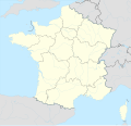
File:France adm location map.svg

Original file (SVG file, nominally 2,000 × 1,922 pixels, file size: 524 KB)
Captions
Captions
Summary
[edit]| DescriptionFrance adm location map.svg |
Deutsch: Positionskarte von Frankreich
English: Location map of France
|
||||||||||||
| Date | |||||||||||||
| Source |
Own work using:
|
||||||||||||
| Author | NordNordWest | ||||||||||||
| Other versions |
|
||||||||||||
| SVG development InfoField | This map was created with an unknown SVG tool.
|
||||||||||||
Licensing
[edit]Usage of this file with:

explanatory notes: Legally binding is only the full legalcode. For a free usage I recommend to respect the following licence conditions:
1. Provide my name as given above: NordNordWest,
2. a copy of, or the URI for, the applicable license: https://creativecommons.org/licenses/by-sa/3.0/de/legalcode,
3. the title of the work,
4. in the case of an adaptation, a credit identifying the use of the work in the adaptation.
This license and the rights granted hereunder will terminate automatically upon any breach by you of the terms of this license. Any of the above conditions can be waived if you get permission from the copyright holder. If you have questions or wish differing conditions, please contact me through nnwest or my discussion page t-online.de
- You are free:
- to share – to copy, distribute and transmit the work
- to remix – to adapt the work
- Under the following conditions:
- attribution – You must give appropriate credit, provide a link to the license, and indicate if changes were made. You may do so in any reasonable manner, but not in any way that suggests the licensor endorses you or your use.
- share alike – If you remix, transform, or build upon the material, you must distribute your contributions under the same or compatible license as the original.

File history
Click on a date/time to view the file as it appeared at that time.
| Date/Time | Thumbnail | Dimensions | User | Comment | |
|---|---|---|---|---|---|
| current | 16:58, 9 December 2015 | 2,000 × 1,922 (524 KB) | NordNordWest (talk | contribs) | == {{int:filedesc}} == {{Information |Description= {{de|1=Positionskarte von Frankreich}} {{en|1=Location map of France}} {{Location map series N |stretching= – |top=51.5 |bottom=41.0 |left=-5.8 |right=10.0 }} |Source={{Own using}} * {{f|France locat... |
You cannot overwrite this file.
File usage on Commons
The following 18 pages use this file:
- France
- User:NordNordWest/Gallery/Location maps
- File:Auvergne-Rhône-Alpes in France 2016.svg
- File:Bourgogne-Franche-Comté in France 2016.svg
- File:Brittany in France 2016.svg
- File:Centre-Val de Loire in France 2016.svg
- File:Corsica in France 2016.svg
- File:France adm-2 location map.svg
- File:France adm location map.svg
- File:Grand Est in France 2016.svg
- File:Hauts-de-France in France 2016.svg
- File:Normandy in France 2016.svg
- File:Nouvelle-Aquitaine in France 2016.svg
- File:Occitanie in France 2016.svg
- File:Pays de la Loire in France 2016.svg
- File:Provence-Alpes-Côte d'Azur in France 2016.svg
- File:Île-de-France in France 2016.svg
- Category:France
File usage on other wikis
The following other wikis use this file:
- Usage on de.wikipedia.org
- Usage on es.wikipedia.org
- Usage on fr.wikipedia.org
- Usage on fr.wikinews.org
- Usage on hu.wiktionary.org
- Usage on ia.wikipedia.org
- Usage on incubator.wikimedia.org
- Usage on kk.wikipedia.org
- Эйфель мұнарасы
- Париж
- Үлгі:Елді мекен
- Үлгі:Елді мекен/doc
- Нант
- Стад де Франс
- Үлгі:ПозКарта Франция
- Тулуза
- Авиньон
- Антиб
- Брест (Франция)
- Альбервиль
- Париж мешіті
- Сен-Мартен-д'Арберу
- Бирьяту
- Сибур
- Андай
- Юррюнь
- Бонлок
- Аспарран
- Маке (Атлантикалық Пиреней)
- Меарен
- Мандионд
- Сент-Естебан
- Сен-Мартен-д'Арберу (Франция)
- Буко (Атлантикалық Пиреней)
- Аранку
- Бардос (Атлантикалық Пиреней)
- Бергуе-Вьелленав
- Бидаш
- Кам (Атлантикалық Пиреней)
- Гиш
- Самес (Атлантикалық Пиреней)
- Еноа
- Камбо-ле-Бен
- Еспелетт
- Итксассу
- Луоссоа
View more global usage of this file.
Metadata
This file contains additional information such as Exif metadata which may have been added by the digital camera, scanner, or software program used to create or digitize it. If the file has been modified from its original state, some details such as the timestamp may not fully reflect those of the original file. The timestamp is only as accurate as the clock in the camera, and it may be completely wrong.
| Width | 2000 |
|---|---|
| Height | 1922.037 |

